Hills, Redbeds and Wet Basements: Pittsburgh's Ground Explained
Pittsburgh's basements reflect Pittsburgh's ground: steep slopes, layered rock, and soils that turn slick when wet. Knowing what is under your lot explains a lot about where water goes and why some walls move.
Pennsylvania's Bureau of Geological Survey says southwestern Pennsylvania has by far the highest concentration of landslides in the state. The U.S. Geological Survey links most of Allegheny County's slope problems to the Pittsburgh redbeds, a red mudstone that weathers rapidly when exposed to air and water.
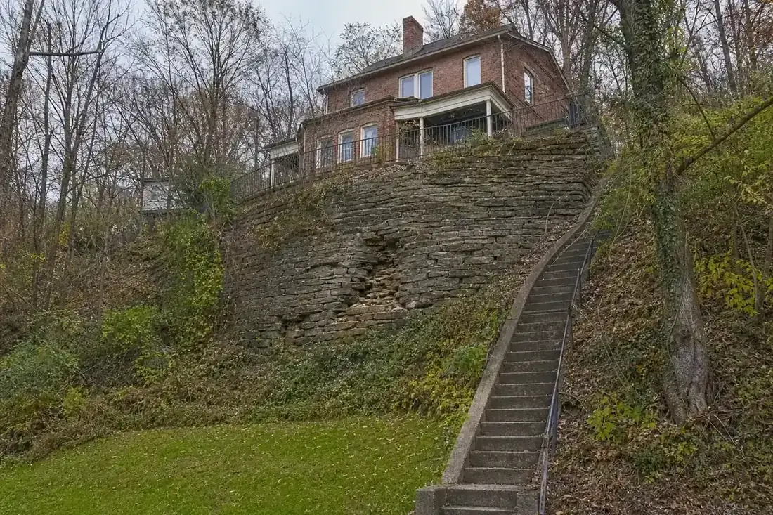
What are the Pittsburgh redbeds?
A layer of red mudstone within the region's sedimentary rock. A 1974 USGS open-file report on the Pittsburgh area found that most areas with moderate to severe slope stability problems are underlain by it, and that it ranges from about 20 to 65 feet thick north of the Ohio River. A 1977 USGS report describes red mudstone weathering very rapidly on exposure to air and water and moving under secondary structures such as driveways, sidewalks and patios, while houses with foundations set in the bedrock itself appeared to stand as well as houses on other rock.
Rain does the work
The airport station averages 41.3 inches of precipitation a year, with 89 days bringing a tenth of an inch or more (NOAA 1991–2020 Climate Normals). Water soaking into a slope adds weight and lowers friction. On a hillside lot, the same water moves downslope to the uphill basement wall, which is why drainage on that side does double duty: it keeps the basement drier and the ground behind the wall less saturated. See hillside wall leaks.
Signs the slope, not just the basement, is moving
- Trees with trunks curved concave upslope, and displaced posts and poles, which a USGS Allegheny County report lists as common evidence of creep.
- Retaining walls bulging or separating at joints.
- New cracks across a driveway, walk or patio that widen after wet spells.
- Doors and windows that begin to bind on the downhill side.
Any of these warrant a structural or geotechnical engineer before a waterproofing contract. The foundation repair page explains the options.
Maps you can check
The USGS published landslide susceptibility maps for Allegheny County in the 1970s, and they remain a public reference for which slopes are most prone to movement. They are broad maps, not a verdict on any one lot, but they tell you whether your street sits in a zone where a careful look is worth paying for. Then compare repair and drainage costs in the Pittsburgh cost guide.
Sources
- U.S. Geological Survey Open-File Report 74-229 (Pittsburgh redbeds and slope stability)
- U.S. Geological Survey Open-File Report 77-832 (red mudstone and structures)
- U.S. Geological Survey: Map of susceptibility to landsliding, Allegheny County
- Pennsylvania DCNR, Bureau of Geological Survey: Landslides
- NOAA NCEI U.S. Climate Normals 1991-2020: Pittsburgh Allegheny County Airport
Where is the water getting in?
A sentence or two helps: water along the uphill wall after rain, a stone wall shedding sand, a sump that runs all spring, a crack that has grown. One independent basement specialist who works in Pittsburgh will get in touch.